To check out you need to login. If you don't have one account you can register here, or contact us.

The GeoMonitoring website, developed in 2022 using ReactJS and .NET 6, continuously adds new features and improvements each year. Key Features:
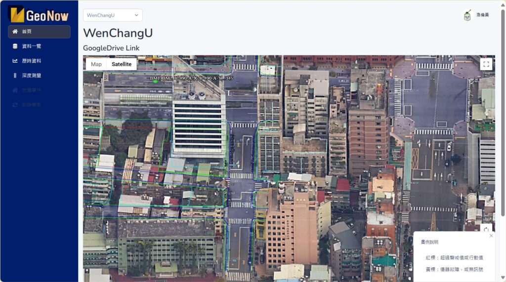
- Google Maps display with status lights, combined with KML to mark work area outlines, retaining wall setups, and tunnel ranges with different colors and line thicknesses.
- Project and user permission separation system.
- Logged-in users can switch between multiple projects without logging out.
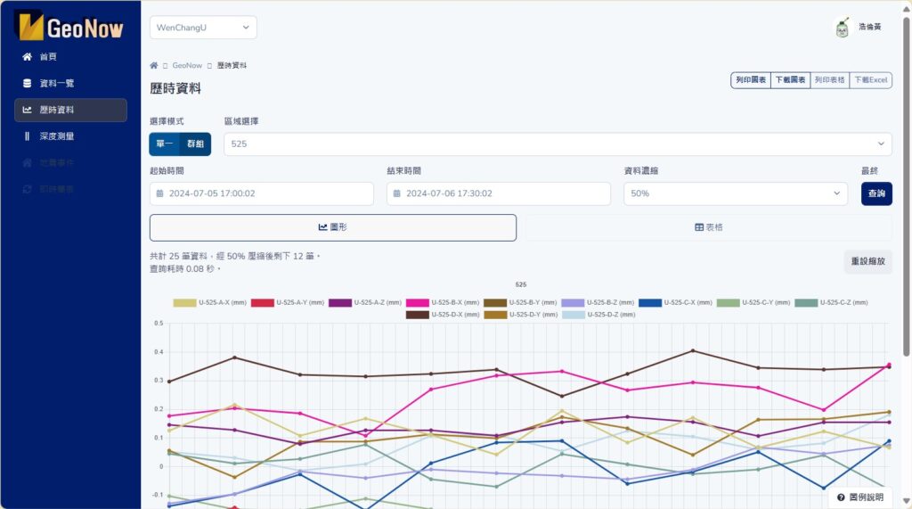
- Data and graphical presentation of seismic measurements.
- Vertical graphical presentation for SAA and IPI.
- Customizable backend settings for various values, including upper and lower limits, KML, and user permission allocation.
- Real-time data audio alarm system that updates every 10 seconds.
- Provides WebService / WebAPI data, supporting client-side JWT or server-side Session authentication. Full-stack software engineers available for customization.
Click to add this item to cart.
描述